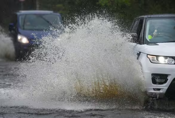
The Met Office has issued yellow weather warnings and an amber wind warning that could see millions of people brace for a stormy weekend as Storm Darragh strikes.

The UK is set to be battered by heavy ra in and strong winds over the coming days (Image: Getty)
The UK is bracing to be hammered by up to four days of consecutive rain and swirling winds, with more than 60 flood alerts activated so far.
The Met Office has issued a new yellow weather warning for the North West for between 2pm and 6pm today that could see up to 30mm of rain fall.
There is a second warning in place for winds of up to 70mph across much of England, Wales and Northern Ireland from 3pm today (December 5) until 3am tomorrow.
In addition, another yellow warning for up to 70mm of rain and 80mph winDs for all of England and Wales comes into force from 3pm tomorrow to 6am on Sunday.
An amber wind warning has also been issued by the Met Office as the fourth named storm of the season is expected to cause chaos across parts of the UK on Saturday.

This map shows the areas where the yellow rain warning applies on Thursday (December 5) (Image: Map Tiler/OpenStreetMap contributors/Met Office)

This mpa shows where the Met Office’s yellow warnings apply on Friday (December 6) (Image: Map Tiler/OpenStreetMap contributors/Met Office)
Six flood warnings, meaning flooding is expected, have been issued by the Government at the following locations:
- B1040 Thorney to Whittlesey Road to the South of the River Nene
- Curry Moor and Hay Moor
- Middle Hampshire Avon from Salisbury to Ringwood
- River Brue and Glastonbury Millstream from Lovington to Highbridge, low lying properties
- Upper Frome at Maiden Newton
- Upper Frome from Maiden Newton to Dorchester
Fifty seven flood alerts, meaning flodding is ppssible, apply to the following locations:
- Chertsey Bourne
- East Somerset Rivers
- Ginge Brook
- Groundwater flooding in the Cranborne Chase area
- Groundwater flooding in the Salisbury Plain area
- Groundwater flooding in the West of Dorset
- Hundred Foot Washes in Cambridgeshire and Norfolk
- Hunstanton coast in Norfolk
- Lower Avon and tributaries
- Lower Frome and tributaries
- Lower Tone and Parrett Moors
- Mid Bristol Avon area
- Middle Hampshire Avon and tributaries
- North Somerset area
- River Bourne and tributaries
- River Cale and tributaries
- River Chew catchment
- River Churn and its tributaries
- River Dikler from Condicote to Little Rissington
- River Evenlode from Moreton in Marsh to Cassington and also the River Glyme at Wootton and Woodstock
- River Frome in Herefordshire
- River Kennet and its tributaries from Berwick Bassett down to Newbury
- River Leach from Northleach to Mill Lane near Lechlade
- River Lugg south of Leominster
- River Ock from Watchfield to Abingdon, and also the Letcombe Brook at Wantage, Grove and East Hanney
- River Piddle and tributaries
- River Ray and its tributaries from Shipton Lee to and including Islip
- Rivers Brathay, Rothay and Winster
- Rivers Duddon, Crake and Mill Beck
- Rivers Ehen, Calder, Irt and Esk
- Rivers Yeo and Parrett, downstream of Yeovil to Steart
- River Thame, Horsenden Stream and Chalgrove Brook
- River Thames and its small tributaries from Calcutt to Lechlade
- River Thames and its tributaries from Days Lock to above Pangbourne
- River Thames and tributaries from Buscot Wick down to Kings Lock
- River Thames and tributaries in the Oxford area
- River Thames for Henley, Remenham, Medmenham and its tributaries
- River Thames for Shiplake, Lower Shiplake and Wargrave
- River Thames for the Abingdon area
- River Thames from Hurley to Cookham
- River Thames from Mapledurham to Sonning
- River Thames from Pangbourne to Purley
- River Windrush from Bourton to Newbridge
- River Wylye and tributaries
- River Yeo and River Parrett Moors around Muchelney and Thorney
- Severn Vyrnwy confluence
- Somerset Frome area
- Tern and Perry catchments
- Upper Bristol Avon area
- Upper Frome and tributaries
- Upper River Derwent, Stonethwaite Beck and Derwent Water
- Upper River Tamar
- Upper Stour and tributaries
- Upper Teme
- West Dorset Rivers and Streams
- West Somerset Streams
- Weymouth Rivers and Streams
Those warnings came ahead of a Met Office amber weather warning for wind as the fourth named storm of the season arrives.
Storm Darragh is expected to bring gusts of up to 80mph late on Friday and into Saturday.
The warning for “potentially damaging” winds is in place for the west coast of Britain from South Ayrshire, Scotland, down to Cornwall, as well as in Northern Ireland. It is in place on Saturday from 3am until 9pm.
Flying debris could pose a danger to life, according to the Met Office amber warning, with some roads and bridges likely to close as well as injuries and possible loss of life caused by large waves.
The warning says road, rail and ferry services could also be hit, along with damage to buildings and a “good chance” of power cuts.

This map shows where the amber wind warning is in force on Saturday (Image: Map Tiler/OpenStreetMap contributors/Met Office)
The local authority areas and regions impacted by the amber wind warning as of 9.30am on Thursday are:
- Blackpool
- Cheshire West and Chester
- Cumbria
- Halton
- Lancashire
- Merseyside
- County Antrim
- County Armagh
- County Down
- County Fermanagh
- County Londonderry
- County Tyrone
- Lothian Borders
- Dumfries and Galloway
- Bath and North East Somerset
- Cornwall
- Devon
- Dorset
- Isles of Scilly
- North Somerset
- Plymouth
- Somerset
- Torbay
- Strathclyde
- South Ayrshire
- Bridgend
- Caerphilly
- Cardiff
- Carmarthenshire
- Ceredigion
- Conwy
- Denbighshire
- Flintshire
- Gwynedd
- Isle of Anglesey
- Neath Port Talbot
- Newport
- Pembrokeshire
- Powys
- Rhondda Cynon Taf
- Swansea
- Vale of Glamorgan
- Wrexham


